
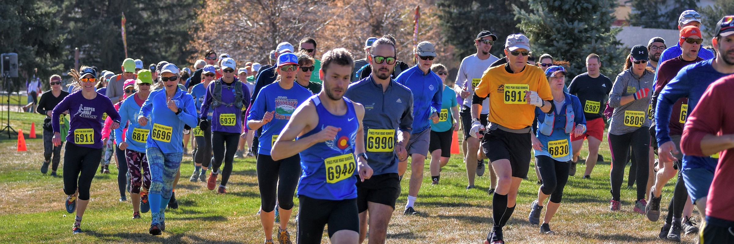

2019 - Fall Series - Get Dirty! Get Muddy!
2019 distances
Running
Four Race Series
The event dates of the Series: October 6th, approx 3.1M, Norris Penrose Event Center October 20th, approx 4M, North Monument Valley Park November 3rd, approx 5.5M, Ute Valley Park November 17th, approx 7.4M, Palmer Park -------------------------------------------------------------------------- #1 - October 6, 2019 – Norris Penrose Events Center COURSE: ~3.1 miles. The trails are wide, up to 8 feet in some places, with many ups and downs. Don’t get your hopes up for an easy run here. DIRECTIONS: I-25 to Hwy 24/Cimarron exit. Drive west to 8th Street and turn left, drive south to Lower Gold Camp Road and turn right. Continue west to the main entrance of the Norris Penrose Events Center. Please park in the north parking lot (on the right after entering). Staging area is on the south side of the building. Follow volunteer instructions for parking. -------------------------------------------------------------------------- #2 - October 20, 2019 – North Monument Valley Park COURSE: ~4 miles. Start in the large grass field and then proceed onto the trails. The course will lead you onto side trails and through the creek, so prepare to be wet. You will return to the grass field for your final sprint to the finish. DIRECTIONS: I-25 to Uintah Street, exit 143. Turn east and drive 3 blocks to Cascade Avenue. Take a left turn (north) and drive 5 blocks to Fontanero and turn left (west). Drive to the end of the road and you will be at the park. Parking will be along the streets, there isn’t a parking lot. Registration/bib pickup is south of the baseball field (down the hill). -------------------------------------------------------------------------- #3 - November 3, 2019 – Ute Valley Regional Park COURSE: ~6 miles. This park is very rocky and hilly, so be ready for the run of your life! The trails are single track in places and if there is water, it will be found. And, watch out for snakes in the area. This is by far the most challenging run of the series. DIRECTIONS: I-25 to Woodmen Road, exit 149. Drive west to the intersection of Rockrimmon Boulevard and proceed west, DO NOT turn right onto Woodmen Road. Drive west to the intersection of Vindicator Drive and turn right (west). Drive past Safeway to Eagleview Middle School. There is limited parking in the school’s parking lot. The race starts on the track. -------------------------------------------------------- #4 - November 17, 2019 – Palmer Park COURSE: ~7.4 miles. In this race, you will run miles on trails that no man or woman would touch – except for the Fall Series runners! Rocks that move, ankles that hurt…but oh what fun! DIRECTIONS: Use the south entrance into Palmer Park, located on Maizeland between Academy Boulevard and Circle Drive. The start is located at the big tree on the southwest corner of the parking lot, north of the sandpit.
Race 1 Only
Norris Penrose Events Center COURSE: approx 3.1 miles. The trails are wide, up to 8 feet in some places, with many ups and downs. Don’t get your hopes up for an easy run here. DIRECTIONS: I-25 to Hwy 24/Cimarron exit. Drive west to 8th Street and turn left, drive south to Lower Gold Camp Road and turn right. Continue west to the main entrance of the Norris Penrose Events Center. Please park in the north parking lot (on the right after entering). Staging area is on the south side of the building. Follow volunteer instructions for parking.
Race 2 Only
North Monument Valley Park COURSE: approx 4 miles. Start in the large grass field and then proceed onto the trails. The course will lead you onto side trails and through the creek, so prepare to be wet. You will return to the grass field for your final sprint to the finish. DIRECTIONS: I-25 to Uintah Street, exit 143. Turn east and drive 3 blocks to Cascade Avenue. Take a left turn (north) and drive 5 blocks to Fontanero and turn left (west). Drive to the end of the road and you will be at the park. Parking will be along the streets, there isn’t a parking lot. Registration/bib pickup is south of the baseball field (down the hill).
Race 3 Only
Ute Valley Regional Park COURSE: approx 5.5 miles. This park is very rocky and hilly, so be ready for the run of your life! The trails are single track in places and if there is water, it will be found. And, watch out for snakes in the area. This is by far the most challenging run of the series. DIRECTIONS: I-25 to Woodmen Road, exit 149. Drive west to the intersection of Rockrimmon Boulevard and proceed west, DO NOT turn right onto Woodmen Road. Drive west to the intersection of Vindicator Drive and turn right (west). Drive past Safeway to Eagleview Middle School. There is limited parking in the school’s parking lot. The race starts on the track.
Race 4 Only
Palmer Park COURSE: approx 7.4 miles. In this race, you will run miles on trails that no man or woman would touch – except for the Fall Series runners! Rocks that move, ankles that hurt…but oh what fun! DIRECTIONS: Use the south entrance into Palmer Park, located on Maizeland between Academy Boulevard and Circle Drive. The start is located at the big tree on the southwest corner of the parking lot, north of the sandpit.
Race date Weather
Conditions on October 6, 2019 — historical Open-Meteo data.
Course
Route map and elevation profile
No course map published yet.
The organizer hasn't released a route for this event, and we don't publish guesses. If you're the organizer, send us a GPX file and we'll draw the profile.
Reviews
Done this event?
If you've participated in this event, share your experience with other runners
Other races near Colorado Springs
Different organizers, within 40 miles, in the next three months
Fall Series - Get Dirty! Get Muddy!

Springs Kids Triathlon
Golden Harvest Half Marathon & 5k/10k - Colorado Springs

Sept 10 - Social Night Ride @ Stratton 5:30 pm *Lights Required!!
🏃 Plan Your Next Race in Colorado Springs
Find upcoming events by distance:
- Colorado Springs 5K Races 43 races
- 10K Run Events in Colorado Springs 18 races
- Colorado Springs Half Marathons 16 races
- Colorado Springs Running Calendar 2026 62 races
Where this page comes from. Race details were last updated on . We re-check listings regularly and again in the week before race day.
- Entries, prices, waves and inclusions — the event's official registration page
- Temperature and humidity — Copernicus ERA5 reanalysis via Open-Meteo (CC BY 4.0)
- Elevation and terrain relief — Copernicus DEM GLO-90, ESA (CC BY 4.0)
- Comparisons and counts — Race Discovery calendar, 112 Colorado Springs events
Spotted something wrong? Tell us and we'll fix it.