
Grizzly Peak Century Ride
About this race
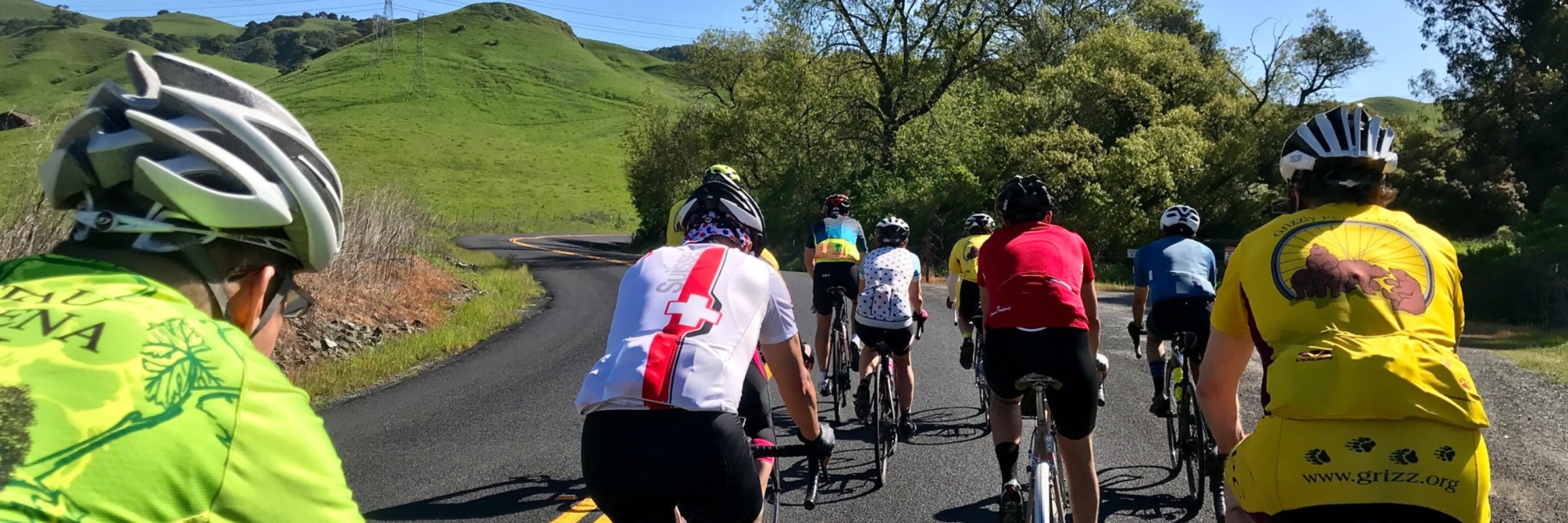
There are four paved routes and two gravel routes to choose from, all of them very hilly:
30 miles (~2,600 ft of climbing)
50 miles (~4,200 ft of climbing)
75 miles (~5,900 ft of climbing)
100 miles (~8,700 ft of climbing)
70K Gravel (~4,200 ft of climbing)
100K Gravel (~6,500 ft of climbing)
Pick your distance
Cycling
30 miles
The 30 mile course has about 2,000 feet of climbing, so it isn't easy!
50 miles
The 50 mile course has about 4,400 feet of climbing. It is the heart of the 75 mile course but skips the northern portion. It offers plenty of climbing and great views. From the start at St Mary's College it climbs the east side of the Oakland-Berkeley hills via Pinehurst Road, then follows the ridge up and over Grizzly Peak and into Tilden Park to the rest stop at Island Picnic Area. It then continues on the ridge and around the north end of the Berkeley Hills to Castro Ranch Road. Then it's on to the Three Bears with a rest stop at Briones Regional Park. Finally, relatively easy riding on Moraga Way takes you back to the start for the post-ride meal.
75 miles
The 75 mile (actually about 73 mile) course with about 6,200 feet of climbing is our most popular route. From the start at St Mary's College it climbs the east side of the Oakland-Berkeley hills via Pinehurst Road, then follows the ridge up and over Grizzly Peak and into Tilden Park to the rest stop at Island Picnic Area. It then heads north to the edge of the Bay and the Carquinez Strait to the rest stop at Port Costa. From there it climbs McEwen Road for a run down into Franklin Canyon and Alhambra Valley, then over Pig Farm Hill and through the hills around Briones Reservoir to the rest stop at Briones Regional Park. Finally, relatively easy riding on Moraga Way takes you back to the start for the post-ride meal.
100 miles
The 100 mile course has roughly 9,000 feet of climbing. The route starts with an early morning south loop to the Ivy Park rest stop. Then it climbs the east side of the Oakland-Berkeley hills via Pinehurst Road, and follows the ridge up and over Grizzly Peak and into Tilden Park to the rest stop at Island Picnic Area. It then heads north to the edge of the Bay and the Carquinez Strait to the rest stop at Port Costa. From there it climbs McEwen Road for a run down into Franklin Canyon and Alhambra Valley, then over Pig Farm Hill and through the hills around Briones Reservoir to the rest stop at Briones Regional Park. Finally, relatively easy riding on Moraga Way takes you back to the start for the post-ride meal.
Gravel biking
70K (Gravel)
The 70K gravel route explores some of the greatest hits in our wonderful East Bay Regional parks. The 70K route is identical to the 100K route without the early morning loop through Lake Chabot Park, so you should have some company on the trails. After a 4 mile paved lead-in, you'll hit the dirt to traverse Redwood Park on Eastridge Trail. Then enjoy the paved Skyline Drive and our namesake Grizzly Peak Blvd enroute to Seaview and other trails in Tilden Park. After the rest stop at Island Picnic Area you'll head down Wildcat Creek and then up and over the ridge to join the road riders for the trip back to St Mary's. The course covers about 41 miles with about 3,800 ft of elevation gain.
100K (Gravel)
The 100K gravel route explores some of the greatest hits in our wonderful East Bay Regional Parks. You'll start with a morning loop through Anthony Chabot Park before the first rest stop. Then traverse Redwood Park on Eastridge Trail and enjoy the paved Skyline Drive and our namesake Grizzly Peak Blvd enroute to Seaview and other trails in Tilden Park. After the rest stop at Island Picnic Area you'll head down Wildcat Creek and then up and over the ridge to join the road riders for the trip back to St Mary's. The course covers about 61 miles with about 6,000 ft of elevation gain. This route will challenge you while helping sharpen your early season fitness and affording you the beauty of the East Bay.
Typical race-day weather
Based on 4 years of Open-Meteo archive data for this event's race dates in Moraga, plus the 3 days either side.
The sun rises at 6:09 AM and sets at 8:00 PM local time (PDT) in Moraga on May 3, 2026 — 13h 51m of daylight.
Course
No course map published yet.
The organizer hasn't released a route for this event, and we don't publish guesses. If you're the organizer, send us a GPX file and we'll draw the profile.
Reviews
Done this event?
If you've participated in this event, share your experience with other runners
Other races near Moraga
Different organizers, within 40 miles, in the next three months
Moraga Turkey Trot-
Oakland Hills Trail Run

Oakland Tech 5km/1 mile Race/Run/Walk Fundraiser

Lafayette Res Run for Education
Where this page comes from. Race details were last updated on . We re-check listings regularly and again in the week before race day.
- Entries, prices, waves and inclusions — the event's official registration page
- Temperature and humidity — Copernicus ERA5 reanalysis via Open-Meteo (CC BY 4.0)
- Elevation and terrain relief — Copernicus DEM GLO-90, ESA (CC BY 4.0)
- Comparisons and counts — Race Discovery calendar, 2 Moraga events
Spotted something wrong? Tell us and we'll fix it.