
2025 - Sea to Sound
2025 distances
Running
Virtual Sea to Sound
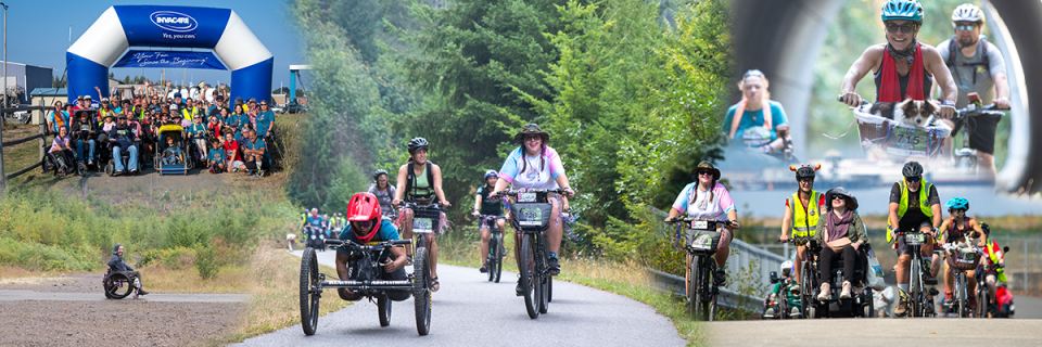
74 miles. We encourage all abilities and modes of transportation to join us. Many will be joining us in-person with wheelchairs. You can do it on your own turf and on your own time schedule. You will even see how far you would've traveled on the ODT as you submit your progress. You can begin your virtual adventure starting July 1.
Cycling
Sea to Sound - Day 1
Day 1 is 20 miles. It begins on the west side of Lake Crescent, at the Camp Creek Trailhead, 36.3 miles west of Port Angeles on Hwy 101, South of Hwy 101 on Cooper Ranch Rd. There are toilets and a picnic area at the trailhead. This section of the trail is stunning, smooth, and remote with big trees and peekaboo views of Lake Crescent. The ride finishes with a few miles of brand-new trail along the banks of Lake Crescent. View maps and more info on day 1 on our website https://www.iansride.com/day1
Sea to Sound – All 3 Days!
This package includes all three days of Sea To Sound! We offer aid stations along the way and transportation assistance when needed. View maps and more info on our website https://www.iansride.com/sea-to-sound
Sea to Sound – All 3 Days Without Shuttle Support!
This package is available to folks who would like to join us for all three days and they have someone to transport them throughout the event. You will still get the same great swag, aid station treats, lunches and course support but will forgo shuttling needs.
Sea to Sound - Day 2
Day 2 is 27 miles. It begins west of Port Angeles, at the end of Crown Z Water Road at the spectacular Elwha River suspension bridge. The trail crosses the Elwha River. Long a source of hydropower and water for mills, the Elwha dams were removed in September 2011, and the largest river flowing out of the Olympics returned to breeding all 5 salmon species, including the giant 100 pound Chinook salmon of earlier years. Although there are some hilly spots, the route is almost entirely paved. There are several excellent access points to join or exit the group ride. Many will be joining us in wheelchairs. We offer aid stations along the way and transportation assistance when needed. View maps and more info on day 2 on our website https://www.iansride.com/day-2
Sea to Sound - Day 3
Day 3 is 21 miles. It begins at Carrie Blake Park. The first half is paved, our shuttles will move you from Gardner to the four corner trailhead of the Larry Scott Trail portion of the ODT. Although not paved, this is a smooth and beautiful trail. Many will be joining us in wheelchairs. We offer aid stations along the way and transportation assistance when needed. View maps and more info on day 3 on our website https://www.iansride.com/day-3
Race-day weather
Conditions on June 30, 2025 — historical Open-Meteo data.
The sun rises at 5:17 AM and sets at 9:17 PM local time (PDT) in Port Angeles on June 30, 2025 — 15h 59m of daylight.
Course
No course map published yet.
The organizer hasn't released a route for this event, and we don't publish guesses. If you're the organizer, send us a GPX file and we'll draw the profile.
Reviews
Done this event?
If you've participated in this event, share your experience with other runners
2025 results — Sea to Sound
Virtual Sea to Sound · 10 finishers
| Place | Name | Time | Pace |
|---|---|---|---|
| 1 | Kymberly Vogeding | 144:34:10 | 6:58 /mi |
| 2 | Tanner Chipman | 113:23:09 | 24:17 /mi |
| 3 | Kelley Barnes | 7:43:00 | 5:40 /mi |
| 4 | Brad Schanke | 27:40:00 | 24:35 /mi |
| 5 | Kim Irwin | 4:16:29 | 3:40 /mi |
Every finisher is on the results page, filterable by distance, gender and age group.
Other races near Port Angeles
Different organizers, within 40 miles, in the next three months

Spruce Railroad Run/Walk

Salt Creek 24

Clallam County Turkey Trot

Jamestown Glow Run/Walk
Where this page comes from. Race details were last updated on . We re-check listings regularly and again in the week before race day.
- Entries, prices, waves and inclusions — the event's official registration page
- Temperature and humidity — Copernicus ERA5 reanalysis via Open-Meteo (CC BY 4.0)
- Elevation and terrain relief — Copernicus DEM GLO-90, ESA (CC BY 4.0)
- Comparisons and counts — Race Discovery calendar, 13 Port Angeles events
Spotted something wrong? Tell us and we'll fix it.