

Shawnee Mission Park Adventure Race
About this race
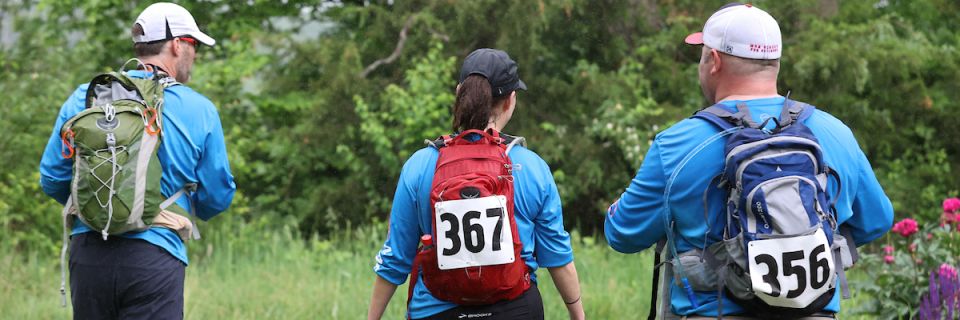
Come take a hike off the beaten path of the most visited park in the state of Kansas at the 2024 Shawnee Mission Park Adventure Race. Racers will enjoy hundreds of acres of nature, hiking, and biking trails, as well as beautifully preserved prairie grasslands. The park sits along the Mill Creek Streamway Park with 17+ miles of paved trails extending from the Kansas River down to Olathe, Kansas, designated as a National Recreation Trail in 2010. The race will happen rain or shine, so ensure you are prepared for any type of weather. Looking for a little adventure? Check out the 2-hour race that is all on foot and open to solos and teams. Have a bike and ready to crush the mountain bike trails? Check out the 6-hour race that will have racers trekking, biking, and paddling their way through the park. The team that completes all the checkpoints (or more than other teams) with the fastest time will win the race.
2-hour racers will trek to all of their checkpoints and may encounter a few extra challenges along the way. This course is designed for the beginner, but you may encounter a few difficult challenges. Racers will need to be prepared for 6-8 miles of trekking on paved trails as well as through brush, trees, and maybe even water.
6-hour racers will receive topographic maps with all checkpoints pre-plotted at packet pickup on race morning. The race will include trekking both on and off hiking trails, biking on single track and paved trails, paddling on the lake, all while orienteering through the park. Racers should be prepared for 20+ miles of biking, 10 miles of hiking, and 1-2 miles of paddling.
There will be several checkpoints that are mandatory (transition areas), but most are not. A team could choose to skip checkpoints and shorten the course and still have an official finish, though probably not place in the top 10. Both courses you will have access ONLY to the gear, food and drink that you have on your bike or in your pack. Checkpoints for the 6-hour Course will be on Topographic maps. The maps are pre-plotted topographic maps from mytopo.com. Your team will need a basic understanding of terrain features and distance measure. There will be very few rules of travel, teams will choose their own route/strategy (with mode of travel specified for checkpoints).
Please note that this event is self-supported meaning you carry with you, all that you need: water, food, first aid, etc. Maps will be distributed on the morning of the event at check in.
Please direct any questions, comments, or concerns to Race Director, Katy Renner at kathryn.renner@jocogov.org
Boats, paddles, and life jackets for the 6-hour race will be provided.
Pick your distance
Adventure race
6-Hour Solo
On foot: 5-7 miles Mountain Bike: 15-25 miles On the water: 1-2 miles
6-Hour 2-Person Team
On foot: 5-7 miles Mountain Bike: 15-25 miles On the water: 1-2 miles
6-Hour 3-Person Team
On foot: 5-7 miles Mountain Bike: 15-25 miles On the water: 1-2 miles
6-Hour 4-Person Team
On foot: 5-7 miles Mountain Bike: 15-25 miles On the water: 1-2 miles
2-Hour Solo
All on foot
2-Hour Family/Team
All on foot
Typical race-day weather
Based on 6 years of Open-Meteo archive data for this event's race dates in Lenexa, plus the 3 days either side.
The sun rises at 6:05 AM and sets at 8:25 PM local time (CDT) in Lenexa on May 16, 2027 — 14h 20m of daylight.
Course
No course map published yet.
The organizer hasn't released a route for this event, and we don't publish guesses. If you're the organizer, send us a GPX file and we'll draw the profile.
Reviews
Done this event?
If you've participated in this event, share your experience with other runners
Other races near Lenexa
Different organizers, within 40 miles, in the next three months

Gr5K
C26 Hyrox Training Clinic

TRYROX Race Series - FullRox
Monster Dash 5K and Lil' Monsters Kids Run
Where this page comes from. Race details were last updated on . We re-check listings regularly and again in the week before race day.
- Entries, prices, waves and inclusions — the event's official registration page
- Temperature and humidity — Copernicus ERA5 reanalysis via Open-Meteo (CC BY 4.0)
- Elevation and terrain relief — Copernicus DEM GLO-90, ESA (CC BY 4.0)
- Comparisons and counts — Race Discovery calendar, 8 Lenexa events
Spotted something wrong? Tell us and we'll fix it.